One-year Diploma in Geodesy launched by IIT Kanpur, No GATE Score for Working Professionals Needed
 IIT Kanpur has launched a new one-year IIT Geodesy Diploma, which will be provided by the Indian Institute of Technology Kanpur, Department of Civil Engineering and National Geodesy Centre. The diploma programme will be offered in three broad fields, namely Geodesy, Navigation and Mapping, and Geographic Information Systems (GIS) and Remote Sensing .
The diploma programme aims at filingl the critical gap in human resources as the country embarks on building major infrastructure, new telecommunication tools and online maps for directions, and mapping of natural resources, said Prof Abhay Karandikar, director, IIT Kanpur. “Geodesy is pivotal to these applications, and we are first in the country to realise the need for such training and capacity building in this critical area,” he added.
Areas of Application of the IIT Diploma in Geodesy by IIT Kanpur
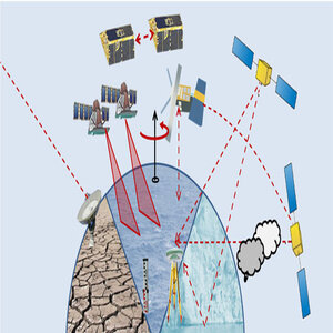
Geodesy as a subject has several applications in the following natural calamities as well as manmade calamities: monitoring earthquake, volcanic, landslide, and weather hazard recognition and response; soil health, water resources, and drought surveillance; climate change including monitoring the polar ice cover; and oil spill clean-ups. The science of geodesy is also helpful in GPS timing and autonomous vehicle development, says IIT Kanpur.
“With the support from the Department of Science and Technology, Government of India, IIT Kanpur has recently established the National Centre for Geodesy (NCG) with Prof Onkar Dikshit, from the Department of Civil Engineering as its Coordinator and supported with the vast experience of Maj Gen (Dr) B Nagarajan (Chairman, National Geodesy Programme) and the expertise of Prof Balaji Devaraju,” said a statement from the Institute.
Who can Opt for the IIT Diploma in Geodesy by IIT Kanpur?
The programme can be undertaken by candidates from different backgrounds such as civil engineering, computer science, information technology, electrical and electronics, mining, geoinformatics, physics, mathematics, earth science, environmental science, geography, and so on with requirements as for the MTech or MS(R) program of Geoinformatics specialization in civil engineering.
The programme is also open to working professionals from Government institutions, industry, faculty members, and researchers in academic institutions involved in teaching and R&D in the areas of civil engineering, exploration, mapping and geo-information systems. The GATE requirement has been waived off for working professionals. Furthermore, financial assistance for the Diploma IIT program in Geodesy is available through the National Centre for Geodesy (NCG), supported by the Department of Science and Technology (DST), Government of India, says IIT Kanpur.

